Short answer
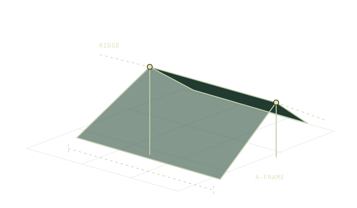
A tarp ridge is an axis with two ends. A bearing of 070° true describes the same axis as 250° true. Keep the reference consistent when comparing it with the forecast wind direction. Record which end is open or protected separately, because rotating the note by 180° does not change the axis.
On this page
Read the axis in both directions
Stand at one end of the proposed ridge and look towards the other. Record a true bearing from the map or a corrected compass bearing. To find the reciprocal, add 180° and reduce it to the range from zero up to, but excluding, 360°. A ridge with one end at 070° has its other end at 250°.
Write both bearings beside a sketch of the shelter. If one end faces a trail or a better entrance, label that end separately. The compass measurement tells you about orientation. It cannot describe the shape of the site, so keep the name of an identifiable feature on the sketch.
Put the wind on the same reference
Forecast wind direction describes where the wind comes from. For the sketch, a wind from 250° travels towards 070°. The ridge from 070° to 250° lies roughly along that wind direction. A ridge from 160° to 340° is roughly perpendicular to it. Both comparisons use true bearings.
Try the two ridge axes in Shelter Studio. The cross-section shows the roof and the small compass drawing shows the plan. The declination note explains how to avoid comparing a magnetic reading with a true-north forecast. Phone headings and compass settings may use different references, so read the display before copying a number.
Put the site ahead of the sketch
Local flow can change around a saddle, through trees or near a steep slope. A regional forecast gives you a direction to examine before leaving. It does not tell you how the wind behaves in every opening or how a stake holds in that soil. Review the wind pitch note and the actual shelter maker’s setup guidance.
Find a site first, including room for the whole pitch and its anchors on a durable surface. The campsite guide covers why the protected-looking corner is sometimes a poor choice. If you cannot make a sound pitch, use a better location or the alternate shelter in your plan.
Label what each arrow means
Use one line with end labels for the ridge. Use one arrow labelled “wind from” with the number written beside its tail. If you also want to consider morning sun, give the sun bearing its own mark. The campsite sun note helps separate that job from the wind sketch.
A small diagram can be useful in a group discussion, particularly when the route notes refer to different sides of a clearing. Leave enough space to record what you observe at the site and what changes in the actual setup. Recheck an assumption when the direction or exposure is visibly different from the plan.
Check the label on any bearing you copied from a screen. If the app shows a relative direction or rotates the map with the phone, reset the view or identify north before comparing it with the sketch.
Common questions
Can I enter the reciprocal bearing in Shelter Studio?
Yes. A ridge points in both directions along the same line. Keep track of which end is which when the entrances or the surrounding ground differ.
Does the wind arrow show what the tarp can withstand?
The arrow compares directions in plan view. Stakes, fabric, exposure and gusts determine conditions that the geometry tool does not model.
Sources
Published 9 November 2026. Reviewed 9 November 2026. Sources support the figures quoted; they do not endorse Trailwright. Report a correction through the owner’s contact page.