Short answer
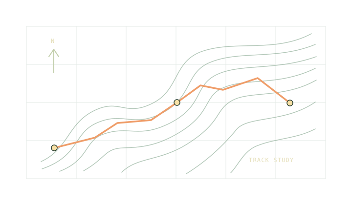
If a GPX track stops and starts again, inspect both ends of the break against a map. Keep the two recorded pieces separate. Measure any missing trail leg on the map and add it to the timetable explicitly. A straight line across a gorge or switchback can look tidy while shortening the trip by a long way.
On this page
Read the segment boundaries
The GPX track structure allows multiple segments. A recorder might start a new one after a pause or a loss of reception. A deliberate route export may also contain separate pieces. The file format records the break, but it does not tell you whether anyone actually walked between the two ends.
In the GPX inspector each segment starts a new path. The distance counter stops at the end of one and starts at that distance on the next. Moving the marker across the break can jump on the north-up trace even though the distance label does not change. That is useful information. The track format note explains why a single file can contain several named tracks as well.
Mark the break on a map
Find the end of the first recording and the start of the second on a current map. Look for the route you intended, including bends, junctions, crossings and access restrictions. Check the map legend and scale. A track shape alone cannot tell you that a crossing exists or that a connecting road is open.
If the ends are 500 m apart in a straight line but the bridge and approach add up to 1.8 km of path, the bridge route belongs in the plan. At 4 km/h, 1.8 km takes 27 minutes on level ground. The diagonal would take 7.5 minutes by the same arithmetic. That saves almost 20 minutes only on paper. Use the map scale worksheet to check your measurement.
Distinguish a gap in the line from a gap in height
Sometimes the outline is continuous while a piece of the elevation profile is blank. The point positions exist and count towards the length. The elevation values have not been provided. Check the elevation gain note for the effects of resampling and where to find a second estimate.
The opposite problem also happens. An export can place a long and implausible jump inside one segment. The inspector respects the point sequence, so it will measure that jump. Check any straight portion that cuts across an obvious barrier. Compare the source recording with the route you would actually choose.
Keep the added leg visible
Give the hand-measured portion its own row in the trip planner. Name the junction where it ends and add time for finding the connection. Mark the distance and ascent as estimates in the route notes so they are easy to update after checking a better map.
If the connection is uncertain, budget a route that can be confirmed. The bailout route worksheet helps compare the time to continue with the time to retrace the approach. When sharing a track and plan, mention the gap explicitly. A person following only the saved trace should know where they will need to read the map.
On a long route, label the start and end of each missing part. That makes it possible to correct one estimate without adding the same distance to two neighbouring legs.
Common questions
Does a missing height mean a missing position?
No. A point with latitude and longitude still contributes to horizontal distance. The elevation chart leaves a gap until a point with a height appears.
What if the app already drew a straight jump?
Treat the jump as suspect. Check it against the map and the original export. Split or correct the trace in the source application if needed.
Sources
Published 9 November 2026. Reviewed 9 November 2026. Sources support the figures quoted; they do not endorse Trailwright. Report a correction through the owner’s contact page.