Latest field notes.
Recent additions to the field library, from GPS tracks to the length of a tarp line.
- 01Shelter & camp · 3 min read
Raise the tarp ridge and watch the floor narrow
Compare two A-frame ridge heights on the same tarp. Work out how much usable ground width moves inward and how to check it before a trip.
- 02Shelter & camp · 3 min read
Check tarp clearance at mat and sleeping bag height
Estimate the width under an A-frame tarp at a chosen height, then use Shelter Studio and a measured test pitch to check your sleeping space.
- 03Shelter & camp · 3 min read
Record both ends of the tarp ridge
Write a two-ended true bearing for an A-frame ridge, compare it with the forecast wind direction and use the result to discuss your pitch.
- 04Pace, load & food · 3 min read
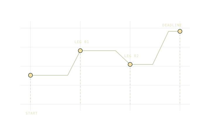
Split a hike where the pace or decision changes
Choose route checkpoints and give each leg its own distance, ascent and slow-ground allowance. Use the totals to build a timetable you can update.
- 05Pace, load & food · 3 min read
Measure a walking pace you can reuse
Separate moving time from stops on a familiar route and estimate your flat walking pace. Use a second leg to check the climb allowance.
- 06Pace, load & food · 3 min read
Put water in the pack’s changing weight column
Calculate how carried water changes pack weight between stops. Keep litres, container mass and an alternate refill plan separate in your ledger.
- 07Maps, slope & daylight · 3 min read
GPX tracks, routes and waypoints carry different things
Find out what a GPX track, route and waypoint actually contain, and check whether your export carries the points and elevations you expect.
- 08Maps, slope & daylight · 3 min read
Why two apps disagree on GPX elevation gain
Learn how sample spacing, missing elevations and smoothing change a GPX ascent total, with a short example that you can add up by hand.
- 09Maps, slope & daylight · 3 min read
A recording gap is a missing leg
Spot GPX segment breaks, separate recording gaps from missing elevations, and recover the missing route distance without drawing a false shortcut.
- 10Water treatment · 3 min read
Give untreated and treated water separate containers
Set up separate containers for collection and treated water, and rehearse a camp routine that keeps untreated water away from the drinking side.
- 11Water treatment · 3 min read
A map symbol is the start of a water check
Read a water source report by date, exact location and authority. Record what is known about flow, access and treatment before counting on a refill.
- 12Water treatment · 3 min read
Plan a backup before a wet filter freezes
Check the manufacturer’s freeze guidance for your water filter, distinguish flow from proof of performance, and plan a fallback before a cold trip.
- 13Weather & altitude · 3 min read
A ridge can take away usable light early
Distinguish published sunset from the time a ridge hides the sun, and give a shaded exit its own usable daylight deadline on the trip plan.
- 14Weather & altitude · 3 min read
Check the elevation behind a point forecast
Compare a trailhead, ridge and exit forecast at their relevant times. Read the grid elevation and avoid treating a point forecast as a summit sensor.
- 15Weather & altitude · 3 min read
Check the drainage above the crossing
Find the creeks and narrow drainages that can affect a hiking route. Use current flood alerts, mark alternatives and leave crossings out of a tight timetable.
- 16Power & batteries · 3 min read
Measure a phone top-up at the USB port
Record watt-hours at the USB port for a repeatable phone top-up. Use the measured energy in your trip budget and keep battery label units separate.
- 17Power & batteries · 3 min read
Test a map, a location fix and a plan separately
Use airplane mode to test a downloaded map, a fresh position fix and your saved trip plan. Check each function before relying on the phone.
- 18Power & batteries · 3 min read
Set a power reserve before allocating charges
Budget a protected share of usable battery energy, then compare routine and delayed-trip charging scenarios in watt-hours before you leave.
- 19Knots & cord · 3 min read
Measure both ridge ends before cutting cord
Compare the line length needed at the two ends of an A-frame. Account for different anchor distances and add a measured tying allowance to each end.
- 20Knots & cord · 3 min read
Measure the cord used by a real tie-off
Use a simple repeatable setup to measure cord needed for a tarp tie-off and adjustment, then add the measured amount to the straight line estimate.
- 21Knots & cord · 3 min read
Keep practice cord separate from the field kit
Make a small unloaded practice setup to follow the working end and standing part. Check the tying sequence before moving to your actual camp cord.
- 22Trip planning · 3 min read
A day hike itinerary you can check at each stop
Turn route distance and ascent into a day hike timetable with named checkpoints, extra time, a finish deadline and an explicit time reserve.
- 23Trip planning · 3 min read
Give each bailout route a decision point
Compare a planned hike with a shorter exit using distance, climbing and access checks. Record the decision point and the time to switch routes.
- 24Trip planning · 3 min read
Give your contact a route and an overdue time
Write a hiking check-in plan with route names, expected finish, an agreed overdue time and clear instructions for the person holding your copy.